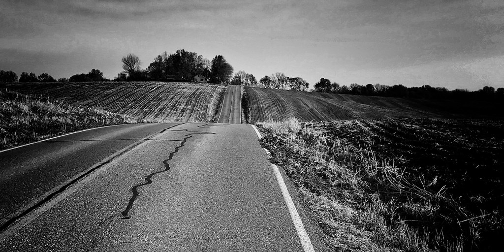
Less than three months ago, the Rock Island Spur Trail officially opened. Yesterday being the most incredible February weather I can ever recall, my day was devoted to exploring a segment of this Rails-to-Trails initiative that connects the southern most section of the Kansas City area to the Katy Trail.

Still in its infancy, the Rock Island Spur Trail (like the Katy) offers snapshot views of scenes not always obvious or accessible by car. Combined with the Katy, the two trails will eventually nearly double the current mileage to form a 450 mile loop from one side of Missouri to the other. I love to explore and discover new places, especially small towns, “discardia,” and architectural elements. In this respect, the new trail does not disappoint.

On this day I’m riding my 1971 Raleigh International. The 700 x 38 Compass tires provide a comfortable ride on a trail surface of packed gravel and clay. From time to time, the path becomes washboard, and I welcome the wide, supple tires that are not fully inflated.
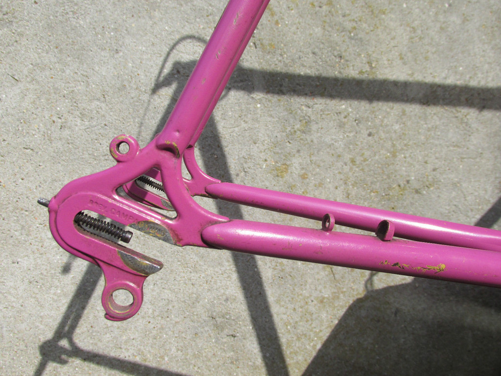
This also offers me a chance to test out the revised contact points on the International. The bars and stem have been replaced, and only just this morning I’ve pulled the Brooks Cambium C17 from a bike that doesn’t see many miles and installed it onto this bike. I enjoy the feel of the Cambium on my Boulder Brevet, and because I’ve tried to closely mimic the cockpit and contact point dimensions it made sense to me to use the same model saddle also.

Emerging from a bank of trees, the trail crosses a paved road a few miles along the route out of Pleasant Hill, Missouri. There is an unimproved trail head at this location that abuts a property I imagine to be a “personal” salvage yard. In other words, it doesn’t appear to be a commercial operation; a pungent, thick smoky fire was burning – tires perhaps? – and the land was very overgrown and littered with wrecked and inoperable cars and trucks and other “discardia.” Trees had taken root and sprouted from the midst of literally everything. This 60’s era sedan has an orange New York license plate attached to the front.
I find “discardia” interesting. Such things, whether they be architectural, vehicular, or simply everyday detritus, are signs of human touch – of human impact. There’s history to be found in these artifacts of our existence … but it’s fleeting, because they are quickly disintegrating. As they return to their constituent elements, whatever sights they’ve born witness to are also disappearing.

Small towns throughout the Midwest are often an intriguing mishmash of architectural styles, with a few extant examples of Federalist style and Antebellum homes to be found if one searches, along with a smattering of Victorian “Painted Ladies,” Art Nouveau, and – more often than not – cautiously woven together Art Deco elements. Of course, bungalows and later box style structures still are the predominant structures, but they bore me and I choose to ignore them unless there is something unique to pique my curiosity about them.

Locating the trail head in Pleasant Hill, Missouri was challenging. No permanent signs have been installed yet. The online map was only generally helpful and provided little context once I arrived in town. In fact, I wound up misinterpreting the map and driving miles out of town in search of a turn off, only to have to circle back again. Siri couldn’t find any reference to a “Rock Island Spur trailhead” and tried to direct me to another town about a hundred miles away on the Katy.
Once back in town I turned toward the older commercial district, planning to stop at the police station for directions. Instead, I came upon a group of four young adults on bikes. Figuring them to be likely trail riders, I asked if they knew where the trail head was located. With a shake of his head and a grin, one guy laughingly acknowledged that things weren’t marked very well. He told me to park in the commercial district (no parking at the trail head???) and pedal down the road I was already on another quarter mile.
Easy enough. Following his directions, I noticed a couple of small temporary directional signs – literally 8 x 10 cards with small lettering stapled to wooden stakes – encouraging riders to “go this way.”
Which I did.
And which, ultimately, led me to a farm, down a farm path, and onto the trail proper. Whew!
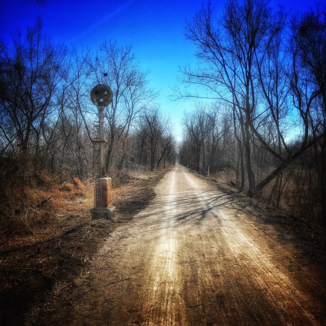
Fortunately, I filled my water bottle before heading out. At least along the first twenty-five miles there are no towns, no places to refill water – and no restrooms. (Fortunately, there are plenty of trees though.) The trailheads I encountered are also still very primitive. Although there is parking (except at Pleasant Hill), there is little else. This differs from many trail heads along the Katy, and I’m sure this will change as the trail is further developed. And to be fair, such inconveniences didn’t seem to mar the enthusiasm of trail users yesterday – I encountered an abundance of cyclists and hikers. (Horses are also welcome on the trail, but leave your ATVs and dirt bikes at home.)
Perhaps I read the mile markers (and the website, and the GPS) wrong, but I should have encountered a town at one point – in fact, I’d planned to make that my turnaround point. But I arrived at the designated mile marker and found…more trees, and a field. Hmm. I decided to keep going another mile. And another. In fact four more. I crossed a couple of roads but I never found that little town, and the afternoon growing late, and me having yet to make any sketches, I turned back toward Pleasant Hill. Having scoped out a few interesting places on the short journey out, my plan was to stop to make photographs and sketches as I leisurely pedaled back toward the car.
Eventually, the Rock Island Trail will be 272 miles in length, from Lee’s Summit in the west to Labadie on the east side of the state. There are plans to extend the trail from Lee’s Summit further into Kansas City, creating even more urban access points. As of this writing, a nearly fifty mile segment is open from Pleasant Hill and connecting to the Katy Trail at Windsor.